AS 1726:2017 sets the national framework for geotechnical site investigations, and in Perth it gets tested against some of the most variable Quaternary profiles in the country. The Swan Coastal Plain stacks Bassendean Sand over weakly cemented Tamala Limestone or Guildford Formation clays, and the transition between them can shift within a single allotment. We run soil mechanics studies that map that variability: borehole logging, undisturbed sampling with thin-wall tubes in clay, and SPT N-values through the sand to pick up loose layers that densify poorly under load. In the northern suburbs around Joondalup the sand can run 40 metres deep, while in South Perth a metre of fill sits directly on stiff clay — two sites less than 20 kilometres apart needing completely different laboratory programmes. Our NATA-accredited lab runs triaxial, consolidation and direct shear suites keyed to the stratigraphy, so the foundation design isn't working off generic parameters. When the sand is clean and deep we often pair the investigation with a CPT test to get a continuous tip resistance profile without sample disturbance, and on sites with limestone pinnacles we may supplement with seismic refraction to map rockhead before setting the drilling grid.
Two boreholes on the same Perth lot can hit clean sand at one end and stiff clay at the other — the AS 1726 investigation density has to match that lateral variability or the foundation model is guessing.
Approach and scope
Site-specific factors
East of the railway line in Maylands the Guildford Clay is moderately reactive and holds moisture for months, while three kilometres west in Mount Lawley you're on residual sand over limestone with a water table at two metres. The risk isn't just differential settlement — it's that a standard investigation plan designed for one suburb will miss the mechanism that dominates the other. In the clay suburbs, seasonal moisture cycling opens cracks in stiffened rafts if the soil suction profile isn't measured; the study needs suction and shrink-swell index tests, not just bearing capacity. On the deep sand sites, the hazard is rapid drainage and loose zones that densify under cyclic loading — Perth's earthquake hazard is moderate (AS 1170.4 hazard factor Z around 0.09), but a loose saturated sand at 3 metres can still trigger cyclic mobility. The soil mechanics study has to answer both scenarios, and that means choosing the lab suite by stratigraphy, not by budget. We've seen too many Perth projects where a cheap investigation missed a 300-millimetre soft clay lens at five metres, and the raft performed like a hinge within two years.
Relevant standards
AS 1726:2017 Geotechnical site investigations, AS 1289 series — Methods of testing soils for engineering purposes, AS 4678:2002 Earth-retaining structures, AS 1170.4:2007 Structural design actions — Earthquake actions, AS 2159:2009 Piling — Design and installation
Related technical services
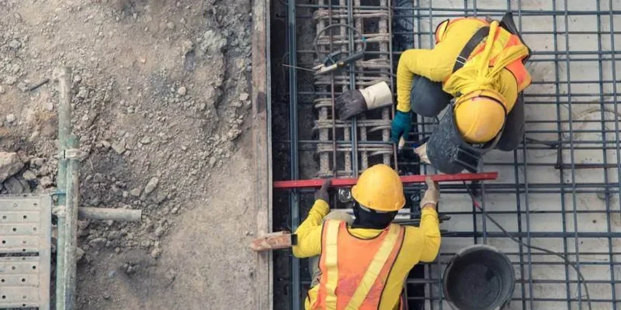
Borehole drilling, sampling and SPT logging
Track-mounted hollow-stem auger or mud-rotary drilling with AS 1289-compliant SPT every 1.5 m. Undisturbed piston sampling in clay, split-spoon in sand, and rock coring through Tamala Limestone where present.
NATA-accredited laboratory testing programme
Triaxial (UU, CIU, CID), direct shear, oedometer consolidation, shrink-swell index, Emerson class, pH and sulfate. The test list is chosen per stratum, not a one-size-fits-all suite.
Geotechnical interpretive report with foundation recommendations
Bearing capacity, settlement estimates, excavation conditions, soil aggressivity, site classification to AS 2870 where applicable, and specific advice on ground improvement if loose or fill layers are encountered.
Typical parameters
Top questions
How deep do Perth soil mechanics investigations typically go?
For single houses on sand, 3 to 5 metres below ground level is common, but on clay sites or where deep fill is suspected we often go to 8 or 10 metres. Commercial and industrial investigations in Perth routinely reach 15 to 25 metres, especially in the CBD where basement excavations interact with the groundwater table and the Guildford Formation.
What does a soil mechanics study cost for a residential block in Perth?
For a standard residential block with two boreholes, SPT logging and a targeted lab programme, the range is typically AU$4,480 to AU$7,140 depending on access, depth and the number of lab tests required. Sites with limestone pinnacles or thick fill can push toward the upper end because of slower drilling and extra sampling.
Is a soil mechanics study mandatory for a building permit in Perth?
Yes — local councils across the Perth metro area require geotechnical information as part of the building permit application, referenced to AS 2870 for residential footings or AS 2159 and AS 3600 for engineered structures. A soil mechanics study that meets AS 1726 investigation density is the standard way to satisfy that requirement and give the structural engineer site-specific parameters rather than conservative defaults.