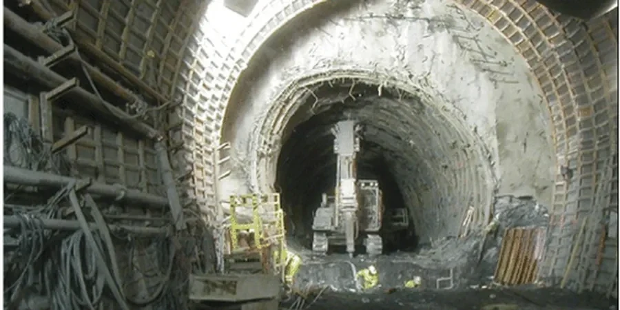
A tunnel boring machine stalled for three days under Hay Street in East Perth back in 2018—not because of mechanical failure, but because the face pressure was miscalibrated for a lens of saturated Bassendean Sand that the desk study had missed. That shutdown cost the contractor more than the entire ground investigation budget. On the Swan Coastal Plain, where the superficial geology swings from loose aeolian sands to stiff Guildford Clay within a few hundred metres, geotechnical analysis for soft soil tunnels is the difference between a smooth drive and a front-page delay. Our team has worked through these transitions on multiple Perth infrastructure projects, combining high-frequency CPT soundings with laboratory triaxial paths to build face-pressure models that actually match the ground, and we calibrate those models against in situ permeability measurements because pore-pressure response in these interbedded sequences controls everything from surface settlement to annulus grouting take.
On the Swan Coastal Plain, the difference between a successful tunnel drive and a ground loss event is often 15 kPa of face pressure—and knowing which layer you are in.
Approach and scope
Site-specific factors
The instrumentation we deploy for soft-ground tunnel investigations in Perth is not the standard 20-tonne CPT truck you see on residential subdivisions. We mobilise a 200 kN tracked penetrometer with a seismic module that records shear-wave velocity every 50 mm, because the small-strain stiffness of Bassendean Sand is what governs face relaxation before the annulus grout sets. In the CBD we often switch to a mini-CPT rig that fits inside a basement car park with 2.1 m headroom, and we pair it with a portable Menard pressuremeter to obtain the in-situ modulus of clay units without the disturbance that affects laboratory samples. Piezometers installed in dedicated boreholes around the alignment remain in place for months, transmitting pore-pressure data that we correlate with tidal fluctuations in the Swan River—a factor that surprises engineers unfamiliar with Perth's hydrogeology. The risk of not doing this level of investigation is asymmetric: a single face blowout in a roadheader-driven tunnel can set a project back six months, whereas the cost of a properly designed site investigation is recovered many times over in reduced contingency allowances.
Service video
Relevant standards
AS 1726:2017 (Geotechnical site investigations), AS 4678:2002 (Earth-retaining structures — applied to tunnel support), AS 5100.3:2017 (Bridge design — loads for cut-and-cover sections under roadways), ASTM D4767-11 (CU triaxial on cohesive soils), ASTM D5778-20 (CPT electronic friction cone)
Related technical services
TBM Face Pressure Modelling
We build layer-specific EPB and slurry-face pressure models using effective-stress parameters from triaxial testing, calibrated against CPTu dissipation data. Outputs include minimum and maximum pressure envelopes per chainage with a factor of safety against face collapse and blowout.
Surface Settlement Assessment
Using non-linear soil stiffness degradation curves from seismic CPT data, we run 2D and 3D finite-element analyses to predict transverse and longitudinal settlement troughs. Reports include damage category assessment for adjacent structures per Rankine (1988) and Boscardin & Cording (1989).
Groundwater Control Design
For tunnels below the water table in Bassendean Sand, we characterise permeability anisotropy through in-situ packer and pumping tests, then design dewatering or exclusion systems. We assess the drawdown radius of influence and its impact on nearby timber-piled structures in Fremantle and East Perth.
Typical parameters
Top questions
What Perth ground conditions are most problematic for soft-ground tunnelling?
The interbedded sequence of Bassendean Sand and Guildford Clay presents the greatest challenge. The sand units are clean to silty, often with perched water, and can fluidise rapidly under positive pore-pressure gradients. The clay is stiff and overconsolidated but contains slickensided surfaces that reduce mass strength. Transition zones between the two materials are particularly difficult because face support requirements change abruptly over short distances.
How much does a geotechnical investigation for a soft-soil tunnel in Perth cost?
For a tunnel alignment in the Perth metro area, a comprehensive geotechnical investigation—including CPT, boreholes with sampling, laboratory triaxial and oedometer testing, and instrumentation—typically ranges from AU$7,090 to AU$25,180 depending on the length of the alignment, the number of investigation points, and the testing suite required. A short pedestrian tunnel investigation sits at the lower end; a multi-kilometre TBM drive with full lab characterisation reaches the upper range.
Which Australian standards govern soft-soil tunnel investigation in Perth?
AS 1726:2017 provides the overarching framework for geotechnical site investigations across Australia. For tunnel support and lining design, AS 4678:2002 (Earth-retaining structures) is commonly applied. Where the alignment passes beneath or adjacent to road bridges, AS 5100.3:2017 governs loading for cut-and-cover sections. International standards including ASTM D4767 and D5778 are also referenced for triaxial and CPT testing respectively.
How do you account for the Swan River's tidal influence on groundwater in tunnel design?
We install multi-level vibrating-wire piezometers in dedicated boreholes and log pore pressure at 15-minute intervals over at least one full tidal cycle. The data is correlated with Swan River tide gauge records from Barrack Street Jetty. The resulting phase lag and amplitude attenuation values are input into the seepage model so that face pressure and dewatering designs account for the dynamic rather than static groundwater regime.